|
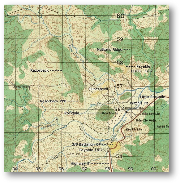
Photos Around the
Rockpile and Razorback
Thon Khe known
to Marines as The Rockpile (9756) is a cone
shaped rock formation, located ten kilometers south of the DMZ. It rises
some 240 meters out of a river bottom. There is a smaller formation to the
northeast called the Little Rockpile (9856). Further east on the south side
of Highway (0056) is another formation known as the Witch’s Tit. To the northwest of the Rockpile
(9556-9659) is another tall formation that runs 3 Kilometers and is known
as the Razorback ridge.
The Punchbowl (9757) was the small hill
in the valley surrounded by all these formations with Mutter’s Ridge to the northeast. The Razorback PPB was located at the south
end and was referred to as Hill 100 referring to the elevation notation in
that grid square. In actuality the PPB was located at an elevation of 200
meters
|